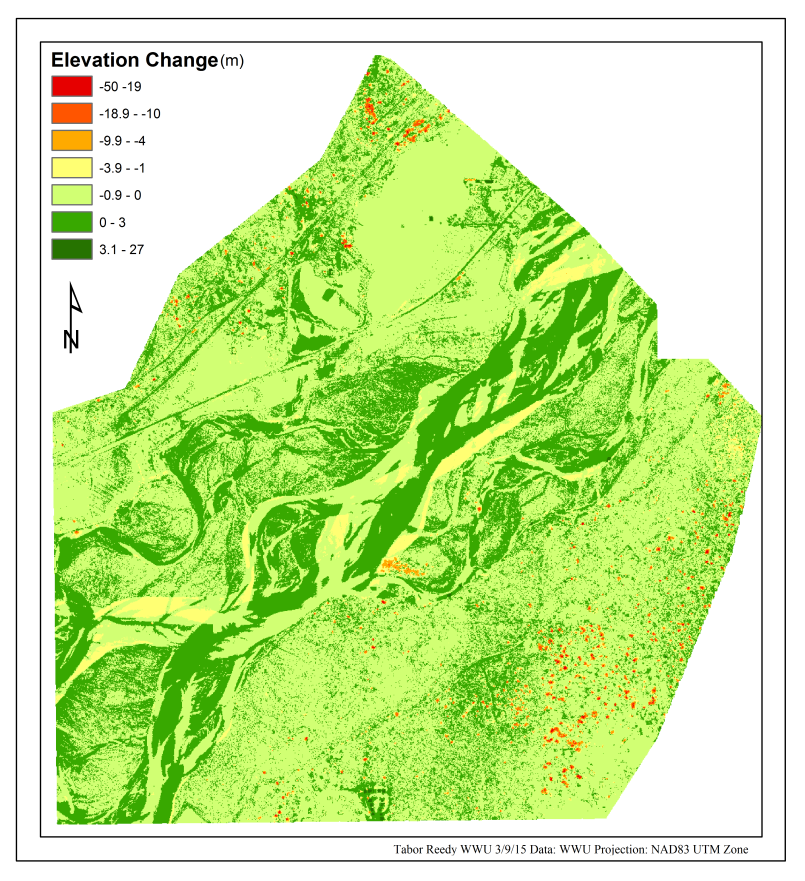
The North Fork of the Nooksack River experiences channel migration throughout time as it entrains and deposits sediment. I use light detection and ranging (lidar) images collected on the North Fork of the Nooksack River east of Demming Washington between 2005 and 2009 to quantify the migration of the channel and the amount of sediment movement. I take original all returns lidar data for the study area and convert it to a bare earth image using functions built into the FUSION software package. Using ArcGIS I then subtract the 2005 image from the 2009 image to show that the channel has moved a significant amount over those 4 years. I also show that a majority of the elevation change within the channel area is between 3 meters loss and 3 meters of gain. The study is a success and easily shows that repeatability of this type of study given the availability of lidar data.
 Figure 1. Channel migration in the North Fork of the Nooksack River between 2005 and 2009. Elevation changes have been binned based on Jenk’s natural breaks with a slight modification for a meaningful zero point. The main focus of the study is on the curvilinear forms between the north east and the south west portions of the map which represents the active channel migration zone.
Full Report:Reedy_Lab7