Quaternary mapping of seven sites along the 1915 MS 7.7 Pleasant Valley earthquake and one site on the 1954 MS 6.8 Dixie Valley earthquake is the basis to describe the style and rate of faulting in the northern Central Nevada Seismic Belt. Cosmogenic depth profiles collected on alluvial surfaces displaced by multiple earthquakes at Siard Canyon in Pleasant Valley and Terrace Creek in Dixie Valley are analyzed to show the Pleasant Valley and Terrace Creek surfaces where abandoned ~110ka and ~70 ka ago, respectively. The Pleasant Valley and Terraces Creek surfaces are displaced to exhibit vertical separations of 5.6 ± 0.5 and 34.6 ± 1.0 meters, respectively.Dividing the offsets observed at each site by the ages of fan abandonment at each site yields estimates of the vertical slip rate equal to 0.47 (0.26-0.83) mm/yr at Terrace Creek in Dixie Valley, and 0.05 (0.03-0.07) mm/yr at Siard Canyon in Pleasant Valley. Diffusion modeling of scarp profiles at two sites within Pleasant Valley show the last earthquake to rupture the Pleasant valley fault occurred ~14 – 27 ka before 1915.Reoccupation and remapping of 7 sites previously studied by Wallace, 1984 shows that the direction of crustal extension accommodated during the 1915 earthquake is oriented between 308.4° ± 12.5° and 294.2° ± 9.3°.
Link: http://hdl.handle.net/11714/3472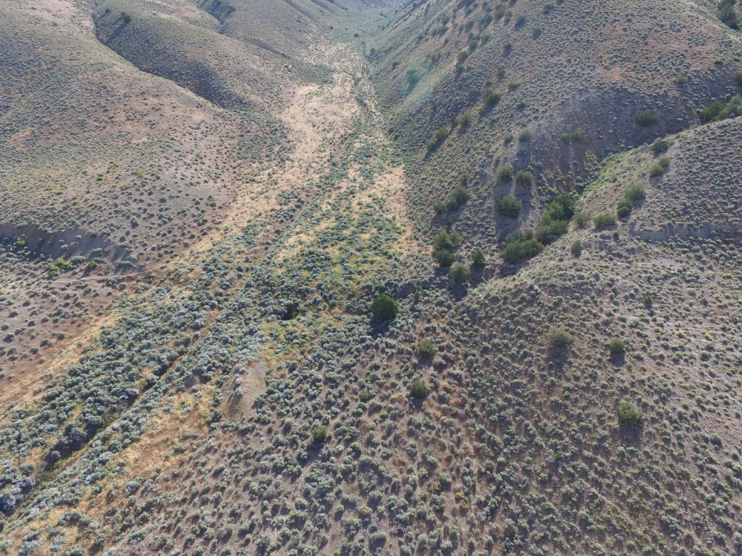 The 1915 single event scarp (smaller in the middle of the valley) and multiple event scarp (Higher surfaces) at Siard Canyon in Pleasant Valley, Nevada. The higher flat surface on the left side of the photo is dated to be ~110 thousand years old.
