ENVS 421 Project 1
The objective of this lab was to use “heads up” digitizing to convert a historical land use economic map of Madagascar into a digital product. The basis of heads up digitizing is using the mouse to manually trace the image to turn the raster image (jpeg) into a vector image (shp). There are many advantages to having digital versions of historical maps, most of which are related to changes over time. The analysis for this project included using georeferencing to place the historical map in the right place spatially, creating a coded value geodatabase to make the classification scheme more efficient and less prone to error, and editing tools to draw shape files over the historical map. Additionally, we were expected to explore historical cartography styles on a modern system, which occupies a lot of time. This map was created entirely with ArcGIS, though using Adobe Illustrator would likely yield a more aesthetically pleasing cartographic product. PDF link included at the bottom if you want to see my map in higher resolution.
 The map That I created in this project.
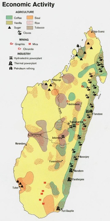
The original image provided to us for digitization
